Nepal Floods Destroy Hydropower and Solar
A massive flood in Nepal on Wednesday destroyed hydropower plants and solar energy facilities, killing at least 538 people.
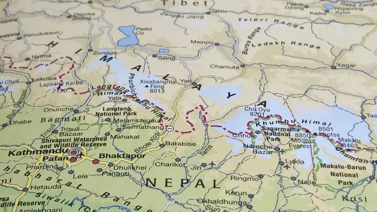
A devastating flood wave in Nepal on Wednesday destroyed multiple hydropower plants and solar energy facilities as it swept through narrow valleys. As of Friday afternoon Nepal time, government reports stated 538 bodies had been recovered and nearly 1,000 people were missing.
The debris flow traveled more than 60 miles downstream into the Rasuwa district, reaching the Bhote Koshi and Trishuli river systems. Satellite imagery analyzed by scientists revealed the disaster began when ice and rocks fell nearly 4,000 vertical feet off the northern flank of Langtang Lirung, a 23,700-foot peak near the Tibet border.
Geomorphologist Dan Shugar posted on Bluesky that the images show a large lake has now formed upstream. This lake could burst, unleashing another flood and threatening rescue workers and communities downstream along the Nepal-China border. "The reports of new barrier lakes are particularly concerning because conditions upstream are still changing," said Jeff Da Costa, a researcher of flood early warning systems at the University of Reading.
Energy Infrastructure Wiped Out
The flood crest topped buildings and homes in the upper valleys. It obliterated everything in its path. The destruction included farms, roads, forests, and critical energy infrastructure. Hydropower plants and solar energy facilities were washed away.
This region lacks a comprehensive early warning system, scientists noted. Da Costa emphasized that close monitoring and timely information sharing between China and Nepal "could buy precious time for communities on both sides of the border." The barrier lakes can fill quickly and may overpower the rubble holding them back.
Climate Change and Mountain Instability
Scientists say climate change is increasing the likelihood of such high-mountain disasters. It melts glaciers and thaws permafrost that has stabilized slopes for millennia. Research published in June found glaciers in the nearby Langtang Valley have shrunk by more than 40 percent since 1815, with loss accelerating recently.
The high-mountain region above 4,000 meters (13,123 feet) is warming much faster than the globe as a whole. "This event really shows the limits of adaptation," said Bethan Davies, a professor of glaciology at Newcastle University. She noted that within minutes, long-established communities were destroyed.
Davies stated that while early warning systems can help, "the only adaptation would be migration away from increasingly hazardous locations." Hermann Kreutzmann, a geography professor at Freie Universität Berlin, said this type of disaster is likely to happen more often as the climate warms.
Communication and Recovery Challenges
Sunil Tamang, a doctoral student from the destroyed village of Syafru Besi, said the scale of loss is hard to comprehend. "People are gone. The friends that I grew up with, uncles and aunties," he told reporters. He had recently helped his village rebuild after a 2015 earthquake-triggered landslide.
Tamang criticized the disconnect between scientists and local communities. He said scientists studying mountain hazards often collect data and leave without effectively communicating risks. "From my experience, that's not happening," he said. He argued findings must be shared in ways people can understand.
One challenge for warnings, according to University of Reading professor Hannah Cloke, was that the flood arrived without rain, which can lead people to ignore alerts. The sheer speed of the wall of water, mud, and rock was another limiting factor. Despite these limits, Cloke said warnings farther downstream did save hundreds of lives.
Source: Inside Climate News